Blog Archives

Lands Run Falls

I was happy to have Indigenous People Day to get out for a short hike. I asked my daughter to go with me and she actually agreed to wake up early and go. This was exciting because it has been over a year since she’s gone hiking with me.  I told her we wouldn’t go too far and it would be pretty.  Check and check.

We woke up at 5:00 am to get to an overlook by sunrise.  Fortunately (or unfortunately) there was a lot of fog.  Since we would be in the North District for Shenandoah National Park for our hike, the overlooks were few and far between on the east side.  They get better as you head south in the park.  I found one and we waited. Finally, the sun came up and illuminated the fog.  I had not brought my 18-200 mm lens and wish I would have for this morning.  I could have gotten a better shot of the fog against the mountains.  My wide shot was okay but sometimes zooming in is also good in landscapes.

foggy sunrise 2

Morning Fog

morning

Overlook Illuminated

We drove back towards our hiking location as I worried about the sun being too bright for a waterfall.  As we started down our path, I was happy with the cover and the fact that the waterfall was located on the west side of the trail. This means the light wouldn’t reach it for a couple of hours.  The hike to Lands Run Falls is very short. It took us no more than 10 mins or so to reach the falls (or the first part of the falls).  Some fall colors were showing and leaves were scattered around the rocks.  This made for great photos.

I am normally alone when I hike but having my daughter with me allowed me to crawl down the rocks. She handed my tripod to me and I took photos from further down. I debated going farther down the rocks but they were slippery and there was no way my daughter would know if I fell (the falls were that loud).  I took some shots and whistled loudly.  Thankfully, she appeared.  I handed her my tripod again and climbed back up the rocks.  As I climbed up, I knew I wouldn’t have made it alone.

waterfall

Towards the bottom of the first drop

cascade2

Cascades at the top

The falls were really pretty.  I think that if we had continued down the trail we would have come to more falls but I kept my promise.  We hiked back up to the car.  The whole hike took about an hour. Super short and sweet.  On our way home, we traveled through the Virginia countryside.  My girl is a lover of small, quaint towns. We drove through The Plains, Virginia and on towards Loudoun County.  We had a wonderful time chatting and driving slow.

I get to go back to Shenandoah soon and I’m hoping the trees are popping with color. Fingers crossed.

Dominion Defends Controversial Decision to Bulldoze Entire Appalachian Mountain Range — The Peedmont

Have you been following the Pipeline that is going to be going through the Appalachian Mountain Range as well as Blue Ridge Mountains (I don’t know if they are one in the same, technically). The pipeline isn’t necessary and will totally ruin how the area looks. The pipeline will also run over/under/through the Appalachian Trail. If you haven’t read about it or are unaware, please make yourself aware. If you care about the area at all, it is important to call people and make your voice heard.

RICHMOND, Va. — Claiming the decision was made with the best intentions, Dominion Energy is standing by their controversial commitment to completely destroy the Appalachian Mountain range. According to Dominion spokesperson Richard Deanders, the demolition of the entire mountain range, which includes famed national parks such as the Great Smoky Mountains, the Shenandoah Valley, and […]

via Dominion Defends Controversial Decision to Bulldoze Entire Appalachian Mountain Range — The Peedmont

A Return to South River Falls

I really wanted to visit a waterfall this past weekend. I never can decide where to go but decided to do a return trip to South River. If you’ve been following me for a few months, you may remember I went this past winter in 0 degree weather. I think I prefer that trip and I’ll explain why below. The South River Falls trailhead is located in the South River Picnic Grounds at mile marker 62.7.  The circuit I hiked is approximately 6 miles long and covers 2,300 feet of elevation.  I started on the South River Falls Trail and went all the way to the base of the falls. You’ll get to a post that says, “Base of Falls”.  Continue down that path. On my way back up, I stay on the fire road. This will cross the Appalachian Trail where you’ll make a left.  This will take you back to the South River Falls Trail where you’ll turn right and just about be at the parking lot.

South River Falls is not my favorite waterfall in Shenandoah National Park. It’s kind of weird looking and split. I much prefer Doyles River Falls but I love the hike to South River. There are many pretty cascades. I know it sounds silly but when I made my way to the river I was surprised at how different everything looked. I know. Duh. But in March we had a massive wind storm and the downed trees added to how it had changed. I had to spend time crawling on rocks, balancing on wet rocks and wading through water to get some of my photos. And I loved every minute. The green does add beauty to the photos but I also loved how wide open everything was during winter. I was able to get to some other small falls because I didn’t have to worry about poison ivy or as many ticks or stinging nettles. I had more to photograph and I like that. Also, I think the falls look really cool when they are partly frozen (better than they look now but that’s a personal opinion).

One of the many cascades

Jump in!

Is there anything prettier?

I kept telling myself to keep moving. It was partly cloudy and I was worried the sun would be too bright by the time I got to the falls. I just couldn’t help myself when I passed certain small falls and cascades. And unfortunately, a few of my shots ended up with dappled sun. And when I got to the falls the sun was hitting the top of the falls. A photographic disaster. (Laughing) I shot it in a few exposures and I guess the final image came out okay. Sometimes I rush and don’t really think about my compositions.

South River Falls

I prefer this side of the falls

Eventually the sun was out to stay so I had to hike back. But, before I forget, I almost ran into a bear on the trail. I was all alone on the trail. And I mean really alone. I didn’t see anyone for 3 hours. I came around a corner and there was a bear. It was as surprised as me. I backed away slowly as I greeted the bear. I expected to hear it run off but it didn’t. I called out a few more times. Eventually, I saw it walk through the woods at a lazy pace. I was thrilled! Bears don’t scare me. I do wish I had gotten a photo but I thought I should follow protocol. I haven’t ever seen a bear while hiking so this was exciting.

Hiking back I forced my pace. With an upcoming Spartan Race this weekend, I wanted to test my fitness and not stop. I did have to stop once or twice but the 2,300 foot climb back up wasn’t so hard. Loved it!

I still recommend South River Falls. If you want to be in the water, it’s a great option! And the hike is just about 6 miles. Any time spent in Shenandoah National Park is time well spent.

Rural Virginia

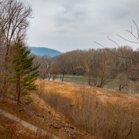
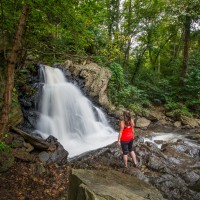
One of the joys of hiking in southern Virginia is driving through all of the rural roads. When possible, I make sure to take the back roads and stay off of the highways. While I was growing up in Michigan, I lived in a somewhat rural area. We had our share of barns, farmland, cows, etc. and I always wanted to live in a big city. Funny how things change.  I am not a “country” person in the stereotypical ways. I hate country music. I wouldn’t want to live on a farm. But I do dream of living in a rural area when I retire.  I live pretty close to rural areas now but because it is forever-expanding, we still get a lot of traffic.

When I was driving on some of the roads around Bland, Virginia there was no one else on the road with me. I had the luxury of pulling over, jumping out of my car, and taking photos. Sometimes I still felt rushed and do wish I had taken just a couple of extra seconds to check my camera but I was able to capture some photos that give me that “feel”.

cows

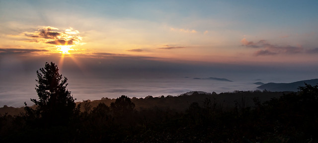
Rolling hills, cows, and the Blue Ridge Mountains


One of my favorite photos is of a church. I had passed it on our way to Bush Creek Falls. Lo and behold this was a rare moment I had someone behind me. I saw it too late and couldn’t pull over. However, on our way back, I made a point of it.  I think about this whole 3 minutes of time and it still makes me laugh.  The area where I pulled over was a parking lot of a closed business.  I stepped out of my car and immediately some dogs on the property across the street started barking. That woke up the cows and sheep on the farm adjacent to them and they mooed and baaed. I was in the middle of an intersection trying to get my settings right while it sounded like a farm erupting. Then, at the house to my right, I heard a screen door slam. If you have spent any time in the country or a country town, you know the sound. They have different sounds. And this particular slam was one of, “Who is that out in the intersection, making all the animals go crazy, taking photos of this church?”  I finished and ran back to my car before someone yelled at me.


church-edit2.jpg

Old Sharon Presbyterian Church, est. 1805

Needless to say, I probably didn’t need to fear. I emailed the photo of the church to an email address I found on the small town’s website. The lady was very gracious and told me all about the church and history. I am sure no one would have been upset with me. Just a small anecdote to share how life is in some very small towns. When you travel, do you take the back roads? If you don’t, I highly suggest it. Especially with our mapping tools we have these days. It is almost impossible to get lost so taking side roads isn’t a big deal.