Category Archives: Virginia

Manassas National Battlefield

A couple of weeks ago I was suffering… not from a cold or sickness or anything serious… just suffering from not having been outside very much. I’ve popped out here and there. I even got outside when it snowed. But a couple of weeks ago, I was tired of the rain. I also feel weird when I don’t “experience” a sunset for awhile. I saw that the clouds were going to clear out and that was my cue to get somewhere.

I decided on Manassas National Battlefield because I had seen a lot of cool sunset photos there and wanted to try for my own. One of the nice things about the place is that there are any number of compositions to be had. There are buildings. Monuments. Canons. Houses. The wide open spaces really give you a lot of options. I reached out to someone who had just moved to the area and asked if he wanted to go as well. We met there and wandered around chatting and shooting. I was worried that I hadn’t really gotten many good photos. I shot handheld for much of the early evening. As it turns out, the sky wasn’t very dramatic. The clouds moved out entirely. Thankfully, though, the sun was powerful and provided a beautiful glow.

One thing I have been attempting is to take more shots at different exposures and combine them. I have done it in the past but I feel more confident with it now and have learned how to do it better. I can honestly say it made the difference with my photos. Have you been to Manassas National Battlefield for photography? I know that I can’t wait to go back. I didn’t care for any of my canon photos so maybe I’ll try to capture them in a more interesting way.

Visiting Virginia’s Newest State Park

Aquia Creek

Last Friday, as I have for the past few years, I decided to #optOutside rather than hit the stores that morning.  I had wanted to visit the newest state park in Virginia:  Widewater State Park.  The morning was chilly but there was little to no wind so it wasn’t bad wandering around the park.

The park is small.  And it is a little difficult to find. I would suggest reading directions on the Virginia State Park’s site or using Google Maps.  The other map services didn’t have quite the right location. Once you arrive you end up next to the Potomac River and Aquia Creek.  If you like water, this is a great park.  There is a location to launch a boat and, when it is warmer, it will have paddling available.  When we entered the park I noticed there were no envelopes available.  Also, I did not see any park rangers working so there was no way to pay the fee.  Hopefully, they will have envelopes in the future because I always want to pay my way at State Parks.

Once we parked, I noticed there was also no large map on a sign anywhere.  It made it difficult to know where the trails were. Thankfully, we had seen one on our way in and walked to that. It is a short trail at only 1 mile.  It is currently the only trail available in the park. It winds by Aquia Creek, into a small wooded area, next to a pond, and back to the parking lot.  We also went off trail a bit just to get some more steps into our day. 

Looking back at the map online, I see that we could have driven to an alternate location on the Potomac River. I would have liked to do that as we did see two eagles fly overhead. Maybe we could have seen more over on the river. 

Overall, the park has great potential. It was completely quiet.  My friend and I were the only two at the park.  When it warms up, however, I think the park will be busy.  Hopefully they will add more trails to the park because the land is beautiful.  When you get a chance, I definitely suggest heading out to check out the park.

Lands Run Falls

I was happy to have Indigenous People Day to get out for a short hike. I asked my daughter to go with me and she actually agreed to wake up early and go. This was exciting because it has been over a year since she’s gone hiking with me.  I told her we wouldn’t go too far and it would be pretty.  Check and check.

We woke up at 5:00 am to get to an overlook by sunrise.  Fortunately (or unfortunately) there was a lot of fog.  Since we would be in the North District for Shenandoah National Park for our hike, the overlooks were few and far between on the east side.  They get better as you head south in the park.  I found one and we waited. Finally, the sun came up and illuminated the fog.  I had not brought my 18-200 mm lens and wish I would have for this morning.  I could have gotten a better shot of the fog against the mountains.  My wide shot was okay but sometimes zooming in is also good in landscapes.

foggy sunrise 2

Morning Fog

morning

Overlook Illuminated

We drove back towards our hiking location as I worried about the sun being too bright for a waterfall.  As we started down our path, I was happy with the cover and the fact that the waterfall was located on the west side of the trail. This means the light wouldn’t reach it for a couple of hours.  The hike to Lands Run Falls is very short. It took us no more than 10 mins or so to reach the falls (or the first part of the falls).  Some fall colors were showing and leaves were scattered around the rocks.  This made for great photos.

I am normally alone when I hike but having my daughter with me allowed me to crawl down the rocks. She handed my tripod to me and I took photos from further down. I debated going farther down the rocks but they were slippery and there was no way my daughter would know if I fell (the falls were that loud).  I took some shots and whistled loudly.  Thankfully, she appeared.  I handed her my tripod again and climbed back up the rocks.  As I climbed up, I knew I wouldn’t have made it alone.

waterfall

Towards the bottom of the first drop

cascade2

Cascades at the top

The falls were really pretty.  I think that if we had continued down the trail we would have come to more falls but I kept my promise.  We hiked back up to the car.  The whole hike took about an hour. Super short and sweet.  On our way home, we traveled through the Virginia countryside.  My girl is a lover of small, quaint towns. We drove through The Plains, Virginia and on towards Loudoun County.  We had a wonderful time chatting and driving slow.

I get to go back to Shenandoah soon and I’m hoping the trees are popping with color. Fingers crossed.

Dominion Defends Controversial Decision to Bulldoze Entire Appalachian Mountain Range — The Peedmont

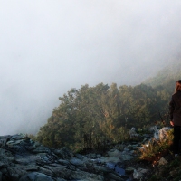
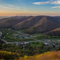
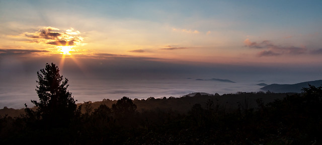
Have you been following the Pipeline that is going to be going through the Appalachian Mountain Range as well as Blue Ridge Mountains (I don’t know if they are one in the same, technically). The pipeline isn’t necessary and will totally ruin how the area looks. The pipeline will also run over/under/through the Appalachian Trail. If you haven’t read about it or are unaware, please make yourself aware. If you care about the area at all, it is important to call people and make your voice heard.

RICHMOND, Va. — Claiming the decision was made with the best intentions, Dominion Energy is standing by their controversial commitment to completely destroy the Appalachian Mountain range. According to Dominion spokesperson Richard Deanders, the demolition of the entire mountain range, which includes famed national parks such as the Great Smoky Mountains, the Shenandoah Valley, and […]

via Dominion Defends Controversial Decision to Bulldoze Entire Appalachian Mountain Range — The Peedmont