Blog Archives
Responsible Photography & Hiking
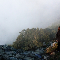
I am taking some time to talk about ethical photography and hiking. I have been wanting to write this for a while but just haven’t had time (hence the lack of updates recently). I was spurred on by seeing a post on Instgram. It was a photo of Falling Springs Falls in Virginia. The photographer and climbed down to the bottom of the falls for the shot and it was being shared on various accounts (the main Virginia Tourism site for one). It irked me. It is illegal to hike to the bottom and fines are involved if caught. Do people get caught? Maybe. Probably not. And maybe they don’t care about the fines but there are reasons some areas are closed off. And by sharing those photos, it encourages others to climb to the bottom.
Now, in all honestly, I have passed a few lines that said, “stay back”. I have certainly hiked off trail but usually where allowed. But when signs say, “This is illegal and you will be fined.” I respect that. Maybe I’m a noob but if all photographers ignored those signs there would be trails where there shouldn’t be and vegetation would start to fade away. I believe in ethical photography. That means respecting laws. It means staying your distance away from animals and wildlife. It means not disturbing nature and following Leave No Trace.
Speaking of Leave No Trace… apparently people are now leaving painted golf balls on trails. It started with painted rocks. Now they have progressed to golf balls. This is from the blog “A Fork in the Road” by Jim Fetig.

This is a big no-no. If you see these, please pack them out. This is from the Appalachian Trail of all places. No rocks, no balls, no painted anything should be left on trails. So many places are being destroyed, we need to be ethical hikers as well and not introduce things that aren’t native to where we are hiking. And no, painted rocks are not native. I have packed out more than one of those. If you want to paint rocks and leave them around your neighborhood, that’s fine. I think that is totally different than Shenandoah National Park.
What do you think? Do you practice responsible hiking, Leave No Trace and ethical photography?

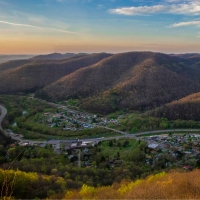
Adventures in West Virginia
I recently completed the West Virginia Spartan Beast Last year, I had vowed to never do it again and there I was, dragging myself up the side of a mountain. I left home Friday morning so I could do some exploring. Of course, a lot of that time was spent just driving. I swear the prettiest places are so far away. Thankfully, I had one of my best friends with me so the trip didn’t seem too long.
Our first stop was at Humback Bridge. Granted, this is in Virginia but close enough, right? It is so close to the highway it made sense to stop. The sky wasn’t great for photos. It was bland and gross. There wasn’t much water so the photos are so-so. We had the spot to ourselves, though, and that was cool. Again, it is too far away to go back very often but another trip during fall would be fun sometime.


Our second stop was the Glade Creek Grist Mill in Babcock State Park. I have seen so many photos of this place and, of course, wanted my own photos. As we neared the park, we received a heavy downpour. I was worried that we might be rained out, but thankfully it stopped just before we entered the park. Whew. I also hoped that it would provide some water for photos. We haven’t received much rain this summer (unlike last year) and I really wanted a nice waterfall photo.
We arrived and saw that there was little water. The only benefit to this was that we could skip around on the big boulders to get different compositions. We took our time and had photos in front of the waterfall – together and alone. My only wish was that I had changed my lens. I am having some issues with my normal lens. Things never quite look in focus and it showed in my photos. When a location is 5 hours away, you want the best photos possible. Granted, it is hard to take a bad photo of the place. It is incredibly picturesque. What I wouldn’t do to go back in the fall or winter (and maybe I will).


We could have maybe fit in one more stop after Babcock but I felt gross and just wanted to shower. Plus, the race was the next day and I wanted to rest up for it.
Yes, I finished the race. I shaved an hour off of last year’s time and that made me happy.
Sunday, on our way back home, we decided to do the Long Point Trail that gives you a good view of the New River Gorge Bridge. We made sure to read about the hike first because we had very tired legs from the race. Thankfully, the hike is very short with hardly any elevation gain. Perfect! The walk in the woods was nice. It felt good to stretch the legs. Walking after a race like that actually helps you recover more quickly as it gets the lactic acid out of the muscles (fitness tip!). We arrived at the overlook and only one other person was there. Bonus! We set up and took a million photos. We were there in the middle of the day so once again, my photos kind of suck. The light was very harsh but whattayagonnado? The view was amazing. It felt great to take some time and just sit there and appreciate it. Eventually, we decided to back. The drive would be long. As we hiked back to the car, at least 30 people passed us. We talked about how happy we were to not be there with all of those people. Many had dogs off of leashes and kids who were yelling. Not peaceful! (PUT YOUR DOGS ON A LEASH!!)


I always knew West Virginia was beautiful. I live so close to part of it but had never really visited that section. Last year, I did Sandstone Falls and Hinton, WV but this was way better. All I can think about is returning. Having a job and responsibilities really puts a damper on my traveling. I yearn for the days when I can just get in my camper and go!

Yosemite National Park
//embedr.flickr.com/assets/client-code.js
Before heading to San Francisco for spring break, my daughter and I discussed going to Yosemite. It would be a four hour drive to/from the park and it seemed like a lot. My daughter wouldn’t be able to drive the rental car so it would be all me. We originally decided not to go. However, her father kept badgering us and asking why in the world would we go all the way to California and not go.
So we decided, yes, we’d go. It was the best decision. We woke up pretty early and were out of the AirBnB by 5:50 am. We stopped along the way for gas and coffee. The scenery was beautiful during the entire trip. Once we started driving up the mountains I knew we were close. I was excited.
If you haven’t been to the park, heed the warnings. GO EARLY! We were there by 9:45 am within the grounds of the park. The problem was there was view after view of mountains, El Capitan, Half Dome, etc. We would stop for photos along the way. We crossed over a magnificent waterfall and I had to stop and try to get a good photo (fail). Finally, I said, “No more stopping!” because I knew we’d never get to hiking. (Note: I stopped two more times). I have to say that at the moment I saw the view of El Capitan, Half Dome and Yosemite Falls together, I teared up. There was something powerful and overwhelming about that view. I tried to explain how I was feeling to my daughter and she felt the same way.
//embedr.flickr.com/assets/client-code.js
Finally, we got into the valley. We wanted to make our way to the visitor center to see about hiking to Mirror Lake and maybe elsewhere. By 10:30 am-ish the parking lots were 90% full. Thankfully, we had a small rental and squeezed in a small area. We walked over towards the visitor center and our first stop was in the Ansel Adams Gallery. As a photographer, I had to go inside. There is no doubt he is one of the greatest artists to have lived. I saw one of his photos and was overcome with emotion. The worker here was so knowledgeable that he actually saved us a trip to the formal visitors center. Bonus!
We walked through the gift shop, got some tshirts, and headed back to the car. We drove towards Mirror Lake and, again, found a place to park. I don’t know how others missed the spot but I am glad they did. We started our hike. Did you know that way back in the day they used to drain Mirror Lake and put up a dance floor/area? We all agreed that letting it go natural is the best option. Obviously, the hike was amazing. It is an easy, short walk to the “lake”.
//embedr.flickr.com/assets/client-code.js
The worker at Ansel Adams let us know that it is filling with less and less water and slowly growing back to a meadow. I was really looking forward to getting some reflection photos and was a little worried I wouldn’t. Finally, we arrived and my fears were unfounded.
//embedr.flickr.com/assets/client-code.js
We walked across the meadow area and got closer to the stream that flows through the area. I could have stayed there all day. The granite rocks exploding up around us made me feel small and tiny. I couldn’t stop looking at them. My daughter really wanted to go look at the rocks along the stream but that meant wading through the water to get there. We took off our shoes and took a deep breath. That water was cold. There were boys on the other side of the stream and they were determined to get across it. It wasn’t too deep and some just took off running. Another group walked across. Their yells and hollering were quite funny. One yelled, “I can’t feel my legs!!!” They all made it though. I took in the scene of my daughter bent over examining the rocks. She wants to major in geology so this was special for her.

Eventually, we turned and walked back. As we drove out of the park, we stopped next to El Capitan. I don’t know if you’ve seen Free Solo yet (I have not – stressful!) but seeing it up close makes it even more amazing that he climbed it and did so quickly. It really blew my mind and I think that I am ready to see the movie now.

As we drove out of the park, I was sad. I love my Shenandoahs. I love the Rockies. But somehow Yosemite implanted itself in my heart and all I can think about is returning and spending years there exploring every inch of the place. The drive back didn’t feel like forever. We were high on beauty. After reviewing my photos I feel like I couldn’t capture the emotion of Yosemite. I guess this is one reason Ansel was so successful. You FEEL his photos and I didn’t do that. But I hope you enjoy them regardless.
Click to see the rest of my photos.

Cool Spring Battlefield
Sometimes I debate with myself if I should share a place or not. Many of us photographers are not disclosing locations of photos because those locations can be overran with people hurrying to get a photo. I do hikes that I don’t share but I decided to go ahead with this post. Why? This is conservation land that is protected and I want people to know what is possible. This wonderful nature preserve sits next to Shenandoah River and is in Clarke County.

Cool Spring Battlefield sits on land that, just a few year ago, was a golf club. When a friend told me about it ages ago, he said, “you know, the old golf club.” Well, I am not a golfer so I wasn’t sure. I did some research and located the area and headed there last year. I loved it. The care of the land is under Shenandoah University. They use it for learning but are also allowing the land to grow back to its nature habitat. There are paved trails that were once for golf carts and some unpaved trails. And the place is huge. I only went a little ways my first time there. This time, I wanted to go to the end. It was well worth it because there is a section that climbs quite a ways and you have a beautiful view of the rolling countryside located on the opposite side of the river.

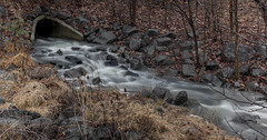
I went pretty early in the morning and was blessed with a mostly empty park. The peacefulness was needed and I enjoyed the silence. While walking, I passed a Yellow-Crowned Night Heron. I was sad to have disturbed it. I attempted a photo but it was just a bit too far away and behind some tall grass so I couldn’t get a good focus. More on the herons later… As you reach the far end of the trail you’ll hear a waterfall. While it is not very large, it is pretty. I’m excited to return to photograph this waterfall in the spring and then again in the fall. I think the scene will be even better! It started to snow pretty heavily while I was attempting photos of the falls so I eventually had to stop. The flakes kept landing on my lens and I couldn’t wipe them away fast enough.

The trail continues on past the waterfall. There is a ranger/park sign structure with a sheet of paper and pen. You are required to sign your name and state where/how far you’ll be hiking. This is a safety requirement and everyone should comply with it. The River Trail eventually meets up with the Appalachian Trail. I’m definitely going to be returning for that section of the hike.
If you like birds, one of the highlights of the park is the Great Blue Heron Rookery located across the Shenandoah River. It is quite a beautiful sight. When I have been there, the sky has been gray so they look like vampires hanging out on the branches with their nests. I counted 13 along with several nests. It is a sure thing that you’ll see herons when you visit this park. As always, please respect them and give them their space.

What I love about this place is that it is a wonderful example of land conservation. Closer to me, in Loudoun County, Goose Creek was a golf course. I saw just last fall that it closed. They will be building houses on the land now and have already built a storage unit. This golf course ran right next to Goose Creek (duh) and it, too, could have been conserved instead of being turned over to more development. Granted, Cool Spring was a historic area due to the battles that took place during the Civil War and that probably went a long way in protecting it from development. However, this is a great option for future golf courses that go under. Let the land grow back naturally and preserve the trails for runners, bikers, hikers, etc. I found out, after emailing a word of thanks to those who administer the land, that there are thousands of acres of land protected around the former course and across the river. I think it would add up to close to 4,000 acres. That is remarkable.
If you decide to visit Cool Spring Battlefield, please respect the rules. Your dog stays on a leash. You Leave No Trace. No fires. Respect the land and stay on trails as much as possible Let’s keep the land pristine and beautiful.